BRIEF HISTORY
Palakkad is a part
of the erstwhile Malabar district of Madras Presidency. The district accounts
for about 11.5% of the total land area of the state of Kerala, with the share
of population is 8.22.%. The literacy rate of the district is low than the state.
The district has got two types of climates. Ottappalam, Alathur and Mannarkkad
are having a climate similar to that of other districts of Kerala, whereas
Palakkad and Chittur are having rather a dry climate similar to Tamilnadu.
However the average rainfall is good for cultivation. There are five Taluks and
163 villages in the district. There are four Municipal towns and Ninety one
Panchayaths in the district. The district is divided into 13 Community
Development Blocks for the effective implementation of various developmental
activities.

Palakkad or Palghat
is the land of Palmyrahs and Paddy fields. Along with Kuttanadu, Palakkad is a
major Paddy growing area of the state. It is often called as the “Gateway of
Kerala”. The Sahya Ranges bordering the region and the 32 Kim. long gap in the
mountains esert a dominant influence on the climate of the region. This Gap is
known as “Palakkad Gap”. In the past, this land was known as Palakkattussery
Etymologist trace the word Palakkadu from Palanilam meaning the dry area.
Palakkad has a long history dating back to the Paleolithic Period, which was
substantiated by a number of megalithic retics discovered from this region. It
also housed the Capitals of two Kingdoms such as Palakkad and Kollengode, which
were in prominence till a Century back.
The ancient history of Palakkad is shrouded. According
to William Logan, the author of “Malabar Manual”, the Pallava Dynasty of Kanchi
might have invaded Malabar in the second or third century. One of their
headquarters was Palakkad, which could be the present Palakkad. For many
centuries the Malabar Region ruled by Perumals. Malabar had been invaded by
many of the ancient South Indian Rulers. After this the Malabar was divided
among their Utayavars. The famous among them were the “Valluvakonathiri” (Ruler
of Valluvanad) Kollengode Raja (Ruler of Venguvanad) and
Sekharivarma (Raja of Palakkad) of Palakkattussery.
The Palakkad Region came under the control of Kollengode Raja and
Sekharivarma Raja of Palakkad.
When the Kozhikode Sammoothiri
invaded Palakkad in 1757, the Palakkad Raja sought the help of Hyder Ali of
Mysore. His help forced the Sammoothiri for retreat. Later Hyder Ali subjugated
all territories in Palakkad, which were under the possession of Kozhikkode
Sammoothiri. Thus whole dominion of Palakkad passed into the control of Mysore
Sulthan Hyder Ali Khan and his son Tippu Sulthan. The war between East India
Company and Tippu Sulthan ended with the treaty of 1792 and all the possessions
of Tippu in Malabar area ceded to the East India Company and it formed the
Malabar District of the Madras Presidency.
LOCATION
Palakkad district
is situated in the South West Coast of India. The district is bounded on the
North by Malappuram District, in the East by Coimbatore district of Tamilnadu,
in the south by Trichur district and in the west by Trichur and Malappuram
districts. The district is between 10’ 21 and 11’ 14 North latitude and 76’ 02
and 76’ 54 East longitude. The total Geographical Area of Palakkad district is
4480 sq.k.ms. Representing 11.53% of the State’s Geographical area. The
Forestland of the district covers an area of 136257 hectares.
TOPOGRAPHY
Topographically the
district can be divided into two regions, the low land comprising the midland
and the high land formed by the hilly portion. The soil is laterite in the hill
and mid regions. Midland is thick with Coconut, Arecanut, Cashew, Pepper, Rubber
and Paddy cultivation.
DEMOGRAPHY
The
district has a population of 2617072 persons according to the 2001 census. The density of the population is
585 per sq.k.m. Decadal growth rate for the period 1991 - 2001 is 9.86% in comparison
with the state figures of 9.42% . The sex ratio of
the district is 1068 females for 1000 males. This is in consonance with the
unique pattern of the state, which is contrary to the All India figure of 929
females per 1000 males. The district has achieved 100 % literacy in
1991, calculated on the basis of population above the age of 6 years.
RIVERS
The most important
river in the district is the Bharathapuzha. The tributaries of Bharathapuzha
are Malampuzha, Walayar, Mangalam, Meenkara, Ayalure, Pothundy and
Kanjirapuzha. There are also two tributaries of the Cauvery in Attappady hill
range.viz. Bhavani and Siruvani. The other important river flows through the
district is Korapuzha,. Kunthipuzha and Nellipuzha are two tributaries from
Attappady and join the Bharathapuzha at Kuttippuram.
CLIMATE
The district has a
humid climate with a very hot season extending from March to June. In the
Western Part of the district whereas it is less humid in the Eastern sector.
The most important rainy season is during South West Monsoon, which sets the 2nd week
of June and extends upto September. About 75% of the annual rain is received
during the south west monsoon period. During the period December to May,
practically no rain is received. The temperature of the district ranges from
20’ C to 45’ C . The maximum temperature recorded at Palakkad was 43’C.
ADMINISTRATION
The District
Headquarters located at Palakkad is about 160 k.ms. away from Kochi and 370
k.ms. from Thiruvananthapuram the State Capital. For the purpose of
administration the district is divided into two Revenue Divisions – Ottappalam
and Palakkad and 5 Taluks viz. Alathur, Chittur, Palakkad, Ottappalam and
Mannarkkard. There are 163 villages in the district. Palakkad Municipality is
one among the oldest municipalities of the state have completed 130 years.
Other Municipal towns are Ottappalam, Shornur and Chittur Tathamangalam.
The district has 91 Panchayaths. The district is divided into 13 Community
Development Blocks for the effective implementation of various developmental
activities
RESOURCES
The Potential of a
district depends primarily on the availability of resources, which can be
utilized to forward integration as raw material for industry. The availability
of all types of transport facilities viz. Road, Rail, and Water are the factors
favorable to the district. Palakkad district is blessed with many resources
like agricultural produces, minerals, horticultural produces, Cattle &
Livestock, forest produce etc. The majoragricultural products include
rice, coconut, Banana, Groundnut, Cotton etc. and they offer maximum employment
potential to the society. There are opportunities for the development of
tourism with tourist spots like Malampuzha, Nelliampathy, Silent Valley
National Park and Attappady.
LAND AND SOIL
The total
geographical area of Palakkad district is 4480 sq.k.ms. Out of this the area
under forest is 1363 sq.k.ms. Palakkad, Chittur and Alathur taluks are more or
less plain except for Nelliampathy Area of Chittur Taluk. But Ottappalam and
Mannarkkad taluks are undulating. The district falls in the midland region
except Attappadyblock which is an Integrated Tribal Development Block and
lies in the high land region.
There are three types of soil (1)
laterite soil seen in Ottappalam, Alathur, Chittur and Palakkad taluks
(2) Virgin forest soil of Mannarkkad
Taluk and (3) Black soil in Chittur and Attappady Valley which is used for the
cultivation of Cotton.
LANGUAGE
The language spoken
by the people of the district is Malayalam, Tamil which is next in importance
here. Those who have languages other than Malayalam as their mother tongue can
generally understand and speak Malayalam. Tamil is common in Chittur Taluk and
‘Palakkad Taluk. Nearly 25 percent of the people are speaking Tamil as their
mother tongue. Konkani,Tulu and Kannada speaking families are also seen here
and there in the district.
RELIGION AND CASTE
Hinduism is
the pre-dominant religion of the district. Nearly 71 percent of the
people belong to the Hindu community. All the sub castes of Hindus
are well represented in the district. The Vellodys, Nedungadies Moothans,
Gupthas, Mannadiars, Tharakars and Ezhuthachans are the peculiar sections of
the Hindu Community of this district. The second largest community of the
district is Muslims forming 25 percent of the total population. The strength of
Christian Community is nearly 4 percent. Almost all the sections of the
Christian Community are represented in the district. A large number of
Christian families from Tranvancore areas have moved to the hilly tracts of the
north and south valleys of the district, in thirst of land and living.
AREA UNDER CROPS
Palakkad district is called the
“Granary of Kerala” The net cultivated area of the district is 198474
hectares i.e. 44 percent of the total
geographical area. Major portion of the cultivable area is used for raising
food crops. About 80 percent of the rural population of this district are
Agriculturists or Agricultural Labourers. The total paddy cropped area
comes to 111029 hectares (totals of three seasons) Palakkad is the only
district in the state where Cotton and Groundnut are cultivated. Area under
Fibre Cotton cultivation is 1472 hect. and Groundnut is 1346 hectares.
Coconut and other
oil seeds occupy a prominent position among the crops covering 57991 hectares
and it is one of the major source of income to the cultivators.
Paddy, Cereals and Millete cultivated in 115697 hectares and it is the major
agricultural activity of the district. . Fibre, drugs etc. are cultivated in
vast areas of the district covering 29991 hect. which is about 65 percent of
the corresponding area of the state. The climate in the district is suitable
for the cultivation of horticultural crops such as Mango. Jack fruit, Pappaya etc.
and the area under cultivation of fresh fruits is 41105 hectares. Plantation
crops such as Rubber, Tea, Coffee etc. are planted in a big way in midland and
highland regions. The area under plantation crops is 35475 hectares in which
rubber occupies more than70 percent . More and more area are brought under
plantation crops. Major cultivation of Cotton in the state is concentrated in
Palakkad district which occupies an area of 1472 hectares.
There is a godown
of Food Corporation of India at Olavacode with a capacity of 50,000 Metric
Tonnes. There are four Ware Housing Godowns owned by the State Government. They
are located at Palakkad, Kozhinjampara, Alathur and Muthalamada. The other
institutions aiding Agriculture are Soil Testing Laboratory at Pattambi, Agricultural Information
Unit, Farmers Training Centres Pattembi and Alathur, Orange and VegitableFarm at
Nelliampathy, Central Orchard Pattambi, Horticultural Development Farms at
Malampuzha and Agricultural; Farms at Muthalamada, Kunnanur, Alathur,
Ananganadi, Eruthempathy and Kongad..
FAIRS AND FESTIVALS
1.Kalpathy Car Festival. It is
celebrated at Kalpathy Viswanatha Swami Temple, which is the oldest Temple in
Malabar. It was built in A.D.1425 by H.H.Kombi Achan, the then Raja of
Palakkad. The Retholsavam was celebrated during the last three days of Alpasi
(Thulam) There are four chariots in this Grammoms. The centre of attraction of
the festival is Kalpathy, Tamil Brahmin’s Village. (see the chapter Kalpathy
Car Festival)
2.Chittur Konganpada. Konganpada is
a grand festival of historical importance, celebrated in the Bhagavathy temple
at Chittur, ten kilometers from Palakkad Town. It is held every year on the
first Monday after the new moon night in Kumbhom (February-March), to
commemorate the victory of Nairs of Chittur over the military of Konganadu
(Coimbatore) led by the Chola King, Rajadhi Raja. The festival starts with
“Chilambu” on Sivarathri in Kumbhom which reminds Kongan’s (Chola Kings)
declaration of war and the frightened people worshipping Bhagavathy and
beseaching her help
3.Jain Festival. There is an
ancient Jain temple at Jainmedu, near Palakkad town. According to a legend, one
sutar (head of the Jains) built this temple 500 years ago for the Jain sage.
Chandranathaswamy. The Jains who came here from Mysore fled from this place
during the invasion of Tippu Sulthan.
4.Nemmara Vallenghy Vela (Nellikulangara
Vela) To invoke the blessings of Nellikulangara Bhagavathy, the
people of Vallenghy and Nenmara conduct a festival on 20th Meenam
(March-April) every year. This
is the famous Nemmara Vallanghy Vela. This beautiful
temple is in the Vallenghy Village of
Chittur Taluk. The flag hoisting ceremony in connection with the vela is held
jointly by the residents of Vallanghy and Nemmara on 9th Meenam. On
all days following the flag hoisting
till the eve of the vela, Kummatti, Karivela,Andivela and similar other folk
rituals are performed. These three ceremonies together are known as Kanyar. The
pomp and splendor of the festival would put it in second place, perhaps only to
the Pooram festival of Thrissur.
5.Ottappalam Nercha Festival. Juma
prayers are held in Ottappalam mosque on Fridays. To commemorate the death
anniversary of a saintly person by name Uthman Auliya, an annual festival is
held in January-February. The special feature of this festival is the
grand procession which ceremoniously brings various things such as rice,
coconuts etc. to the mosque as offerings. On the next day, a feast is held
where the various articles received will be cooked and distributed to the poor.
6.Sivarathri Festival at Kallekulangara. The
festival is conducted for nine days and ends with an arat of the deity
Hemambika in Kalpathy River. The festival is celebrated in the Kallekulangara
Bhagavathy Temple,at Akathethara.
7.Manappulikavu Vela. The important
festival of Manappullikavu at Yakkara is the annual Vela.
8.Arat Festival in Kachanamkurichy Temple.
Kachanamkurichy temple is an important Vishnu temple. The arat festival here in
the month of May attracts many people.
9.Navarathri festival in Pallavur Siva Temple,
Amavasi Festival in Trippallur Siva Temple, Pooram festival in Kongad
Bhagavathy temple and Retholsavam at Kodumba Subrahmanya Temple are some of the
important festivals which attracts a large number of devotees. Mahamakom is
also held in the Kodumbu temple once in twelve years.
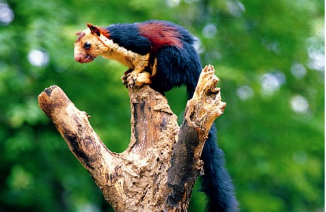
PLACES OF TOURIST INTEREST
Palakkad, which
lies at the foot of the Western Ghats, the dreamy land of misty monuments with
its ever green tropical forests, dams, wild life sanctuaries, rivers, rare
birds and animals, historical monuments, places of worship and traditional
Ayurvedic treatment centres, has tremendous scope and immense potential to
become one of the best tourist destinations in the country. The district is
gifted with the beauty of virgin and verdant Nelliampathy hills, the precious
and unique Silent Valley National Park, the famous Parambikulam Wildlife
Sanctuary, Attappady hills and more than half a dozen dams like Malampuzha,
Mangalam, Pothundi, Kanjirapuzha, Siruvani and Parambikulam..
Nelliampathy

Nelliampathy Hills
are extremely fascinating and offer an easy escape from the sorting summer of
Palakkad. About 75 kms from Palakkad is this cool hill resort. The height of
the hills ranges from 467 metres to 1572 metres. It has immense trekking
potential. Seethargundu, at Nelliampathy offers a fantastic view of the valley below,
a wide angled panoramic picture of about one third of Palakkad, beautiful and
resembling the Green Valley of Kodaikanal. The total area is about 82 sq.kms.
The highest peak in the range is Nellikotta, also called Padagiri. It is
1585.08 metres above sea level. The other major peaks are Vellachimudi,
Valiyavana, Mayanmudi and Vela Vanchan, each about 1200 metres high. The annual
average rainfall in the area is 4.244 mm. The temperature varies between 15’ C
in December and 30C in April, the mean temperature being 22’C. The Pothundi
reservoir glints in the distance like sapphire in a sea of emerald. The 1000
metre high waterfall is one of the major attractions. Seethargundu got its name
from the legend that Sita Devi, during the vanavasa period with Sri Rama, took
a bath here. During Deepaval, a large number of devotees gather here.

Malampuzha

Malampuzha Garden is the Vrindavan of Kerala. Malampuzha exudes the charm of the harmony of nature a perfect synchronization of the grandeur of the mountains blending with the serenely of rivers. It is 12 kms from Palakkad. There are lush green lawns, Innumerable flower beds glittering pools, fountains and avenues. There is a fresh water aquarium. A snake park and a children’s park with a toy train, which await the pleasure and delight of children. The reservoir is ideal for boating and fishing. The Garden House has a unit of water ports. A small garden in the Japanese style gives a . touch of exotic charm to the landscape. So does the hanging bridge across the river. Another items of interest in the part is the imposing concrete sculpture of YAKSHI, done by the renowned Kanai Kunhiraman. The Passenger ROPEWAY, the first of its kind in South India, offers adventurous and delightful air journey of 20minutes across the gardens, giving a soul string view of the gardens, the distant hills that kiss the heavens and the blue strip of the reservoir. There is a ROAD TRAIN for amusement ride on wheels. In the vast expanse of the Malampuzha Garden and its vicinity.. There is a TELESCOPIC TOWER in the garden providing a terrestrial view upto 40 miles. The first ROCKGARDEN emerged from the Master creator Padmashree Nek Chand of Chandigarh, in South India is at Malampuzha. Modeled after Appu Ghar of Delhi and Essel World of Bombay the first Amusement Park of Kerala named FANTASY PARK is at Malampuzha. The Park has modern thrilling Rides over 8 acres plot landscaped beautifully with Garden and Fountains.

Pothundy
Pothundy is 38 kms
south of Palakkad town. An irrigation project was commissioned here in 1968
with an estimated cost of Rs.234.25 lakhs, consisting of an earthen dam with a
spillway section across the tributaries of Ayalure River. Its 10 kms right bank
canal ad 8 kms left bank canal irrigate an area of 5465 hectares in Chittur and
Alathur Taluks. The project also provides water supply to Nemmara and Ayalure
Villages.
Ottappalam
This was the centre
of political as well as tenant movements in South Malabar of the erstwhile
Malabar province of Madras Presidency. The festival at Chathan Kandar Kavue is
very famous one in Ottappalam. The legend goes that the temple was built by the
local Kanjoor Namboodiri family at a place where a scheduled caste person
called Chathan found a stone bleeding while he was sharpening his knife on it.
The deity of this temple is Durga. The annual festival is Talapoli which is
celebrated on Avitam day in Meenam. Nercha festival in the Ottappalam mosque
attracts the local Muslims in large numbers. It is said that a saintly person
by name Uthaman Auliya had lived and dies at this place. An annual festival is
held at this mosque on his death anniversary.
Silent Valley

The Silent Valley
National Park, with an area of 90 sq.kms, is situated in the north eastern
corner of the district. It rises abruptly to the Nilgiri Plateau in the north
and overlooks the plains of Manarkkad in the south. The river Kundhi descends
from the Nilgiri hills above, a altitude of 2000 meters traverses the entire
length of the valleys and rushes down to the plains through a deep gorge. River
Kunthi never turns brown, it is crystal clear, perennial and wild. The Silent
Valley National Park, is probably one of the most magnificent gift of nature to
mankind, a unique preserve of tropical rain forests in all its pristine glory
with an almost unbroken ecological history. Thanks largely to its difficult
terrain and remittances the extent of degradation is minimum comparison with
other sanctuaries. There is a huge wild tree of Kattualying variety. It is
hollow within and can hide atleast 12 people in it.
Mangalam
Located 48 kms
south of Palakkad town, Mangalam is mainly occupied by settlers from other
parts of the State. Mangalam dam is located near the NH 47 about 14 kms. South
of Vadakkencherry village. The dam is constructed across Cherukunnapuzha a
tributary of Mangalam River. It is located in picturesque surroundings. The
reservoir fringes on the forest area where there are deer, wild elephants and a
variety of birds. There are beautiful parks and lawns adorned with statues.
Siruvani
The Siruvani
Project is in Sholayur Panchayath. The dam constructed across the River
Siruvani, is for supplying drinking water to Coimbatore Corporation of
Tamilnadu. The dam is surrounded by reserve forests. The distance from
Edakkurissi to Siruvani Dam is 22 kms. The scenic beauty of Siruvani is simply
enchanting. Muthikulam hill is situated on the eastern side of the dam. There
is a natural waterfall in the hill.

Meenkara

Meenkara is a
fascinating spot by virtue of the dam, garden, fishponds and natural beauty. It
is 32 kms.south east of Palakkad Town. This Dam is built in the river Gayathri
which flows into Bharathapuzha.
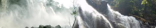
Dhoni
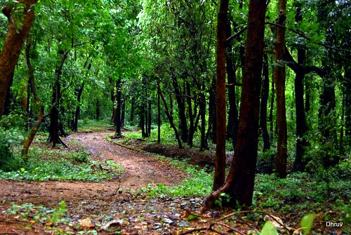
Dhoni is a reserve
forest area, 15 kms from Palakkad town. The forest has among other captivating
signs, a small but splendid waterfall. The site can be reached after a fairly
long climb of 3 hours from the base of Dhoni Hills.
Parambikulam

Parambikulam wild
life sanctuary extends over an area of 280 sq.kms. It is 110 kms away from
Palakkad via. Pollachi. The oldest and highest teak tree “Kannimari Teak” is
situated here. Three Dams were constructed on the hilltop. They are
Paruvarippallom, Thunakadavu, and Parambikulam. for the irrigation of Pollachi
Taluk of Tamilnadu and Chittur Taluk of Palakkad District. It is the place
which is famous for teak plantations. Boat cruises is provided in the
Parambikulam Reservoir. The Rest Houses of the State Forest Department at
Thunakadavu, Thellikkal and Elanthode and a tree house in Thoonakkadavu offer
lodging facilities. The Giant Kannimari Teak and the wild animals in the forest
area are a sight to dream of.

Kanjirapuzha

Kanjirapuzha Dam is
situated about 38 kms. from Palakkad. The water spread of the dam lies in a
single stretch. An evergreen forest, by name ‘Vettilachola’ is immediately
beyond the reservoir which is surrounded by hills and during rainy season, the
mountain will be covered with mist. All this makes the area extremely beautiful
and picturesque. There are three islands in the reservoir with plenty of fish
(including commercial varieties) grown by the Fisheries Department.
J.P.Smrithi Vanam
Loknayak
J.P.Smrithi Vanam and Deer Park is in an extent of 100 acres of reserve forest
at Walayar in the border of Kerala and Tamilnadu on the side of N.H.47. Deers
and other animals move freely in this park. Facilities for elephant ride is
provided. The distance from Palakkad town is 22 kms.
Mayiladumpara

Peacock Sanctuary.
Myladumpara Choolannur Peacock Sanctuary is 30 kms. away from Palakkad. It is
well known as a grove abounding in Peacocks.
Palakkad Fort

Palakkad Fort,
situated in the Palakkad Town, is the most beautiful and best preserved forts
in Karala. The sober silence of the granite wall reminds the old tales of
valour and courage. It was constructed in 1766 by Hyder Ali of Mysore and his
son Tippu Sulthan. In 1790 the fort was taken over and remodified by the
British East India Company. The fort is protected by the Archeological Survey
of India. Martyr’s Column, Open Air Auditorium called “Rappadi” and Tourism
Information Centre of District Tourism Promotion Council are there in the
spacious Fort Maidan. The Children’s
Park and ‘VATIKA’ are just on the
side of the Fort. The fort was situated in the middle of Palakkad Gap with an
area of 15 acres.
Kottayi
It is 15 kms away
from Palakkad. Kottayi is the native place of the Late Chembai Vaidyanatha
Bhagavathar, the doyen of Karnatic Music.
Mennvallom
There are 10 steps
of Water falls at Meenvallom, the originating point of Thuppanadu River. The
height of the falls varies from5 to 45 metres. The distance from Palakkad is 37
kms.
Attappadi
Attappady is a
tribal abode. Irular, Mudugar and Kurumbar are the main tribal groups. They
live in forest in closely built huts called ‘Ooru’ (hamlets) Government have
constructed some concrete programs to uplift the tribals. The Intensive Tribal
Development Project, Attappady implementing the tribal development schemes.
Thunchan Gurumadom

Across the lush
green fields, two kms. from Chittur Town on the banks of river Sokanasini an
old building where Thunchathu Ramanujan Ezhuthachan, regarded as the father of
Malayalam Language, lived in the 16th Century. People call it Gurumadom and it
is here that he transcreated the two great Sanskrit epics, the Ramayana and the
Mahabharatha, for the common people. At the Gurumadom one Srichakra and a few
idols worshipped by him the stylus the wooden slippers (Padukom) and a few old
manuscripts are exhibited. It is on Vijayadasami day that the memorial gets the
maximum number of visitors with hundreds of children brought here for a
ritualistic initiation into learning.
Kunchan Smarakom

Kalakkathu Kunchan
Nambiar represents an age and its culture in the field of Malayalam literature.
He was the native of Killikkurissimangalam in Palakkad. Now, the Kunchan Smarakom
is a national monument and is being governed by a Committee appointed by the
Government. A three year course on Ottan Thullal, Seethankan Thullal and
Parayan Thullal was started with the help of artists attached to this
monuments. Every year May 5th is celebrated as Thunchan Day. A library and an
Auditorium are attached to this monuments.
There are so many
other tourist centres are also here. Important of them are Sree Rama Temple and
the Spring at Thenari, the Kattilmadom Temple, Ruins of a mud fort near
Chalissery etc.